A Journey Down the Salt Trail
For the past three years we’ve been working on a VR documentary film about the Grand Canyon and the many ecological threats posed by commercial overdevelopment. After already taking two trips down the Colorado River by raft and one trip to Grand Canyon National Park to interview the superintendent, we still weren’t satisfied with the shots we got at the confluence where the Little Colorado River (or LCR) meets the Greater Colorado River.
Luckily for us, we had an opportunity to shoot a Navajo Council meeting on October 31 where they would vote on the fate of the Grand Canyon Escalade project, and it just so happened that early November was a great time to hike to the confluence. This is where our journey started, three VR filmmakers trying to convince ourselves we could handle the 18 mile round trip trek through a treacherous desert canyon to one of the most beautiful places on earth.
The ancient Hopi Salt Trail is a three mile, 3,300 foot descent into the salt canyon down to the LCR. From there, it’s another six miles of trail along the river to the confluence. November is known to be a prime time for this spot, so we knew this was an opportunity we had to take.
The Plan
Our plan was to hike the 3,300 foot descent on the first day, camping at the bottom near the LCR that night. We would then leave our camping gear and carry only our cameras, food, and water in our packs on the 12 mile round trip to the confluence on the second day. After a second night of sleep at our camp, we would climb up the 3,300 foot elevation gain back to the trailhead on the rim.
On Friday, November 3, we headed out for the trailhead from Grand Canyon National Park after filling up on a good sized breakfast. After a two and a half hour drive, we arrived at the trailhead at around 10am. It was easy enough to find, all of the dirt roads through the Navajo land were relatively easy to locate on Google Maps and we could easily plan our route. The approach to the trail brings you through beautiful territory. You’ll drive down roads where you can see sage brush for miles, wild horses, and the occasional small ranch or hogan on the horizon.
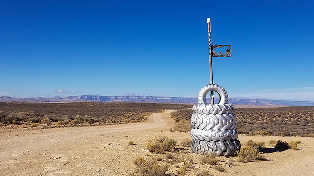
The trail head had a large parking area, when we arrived there was one other vehicle parked there. From the north end of the parking area a small trail gradually winds it’s way down to the actual rim of the salt canyon - the real start of the trail. It’s marked by two large rock cairns (rock piles), and drops off almost immediately. We could actually see a small sliver of the LCR way out in the distance, and even from here we could see it was glowing blue.
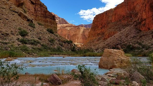
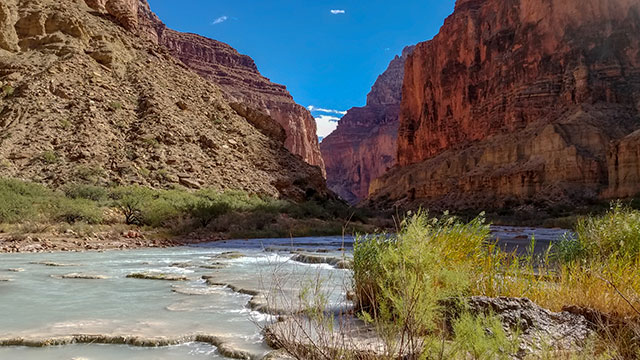
If you have seen photos of the LCR when it’s running blue, you know this color, especially in contrast to the canyon walls, looks almost like it’s photoshopped. Too blue to be natural. The high content of travertine and limestone in the water causes this, it’s simply amazing! You have to see it to believe it. But if there has been any significant rainfall in the area in the past 10 days, it’s very easy for the river to be washed out and all of the sediments will turn it brown. The first time I visited the LCR back in 2015, this was the case. After watching the weather, we knew there would be a high chance of being able to see the blue water and capture it with our new 360 cameras.
Dropping In
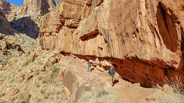
From the top, it looks like a cake-walk after the first initial drop, but I will assure you it’s nothing like that. One might think you can just drop in and follow the bottom all the way to the LCR, but the drop offs would make this very difficult. The trail actually crosses the canyon, and takes you up over many ridges, you’ll climb and descend a few times before you reach your destination.
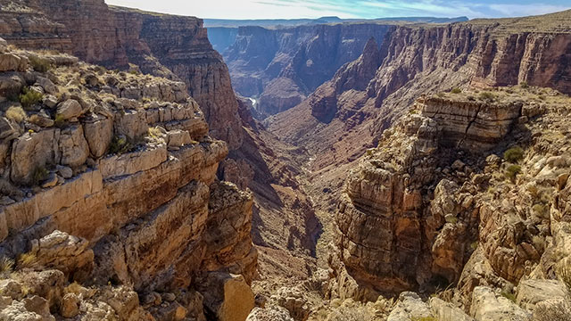
We found the various rock cairns on the trail to be relatively easy to find, weather was dry and temperatures were warm but not too warm. We assumed that hiking poles might be helpful, but in most cases the carbon fiber camera pole we used as a walking stick just got in the way. Much of the climbing over boulders will require the use of both hands. Climbing down was particularly challenging to keep your footing, covering the three miles took us almost six hours, with stops for photos along the way. There are a few spots where having someone pass your pack will be helpful, and at least one ledge you may want to crawl over to keep your footing (because of low clearance above).
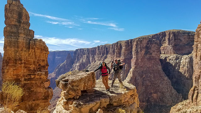
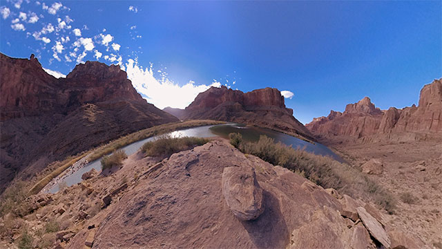
The views on the way down were absolutely spectacular. You’ll find yourself wanting to take several breaks just to take photos, we shot many panoramas along the way. One spot in particular we really liked was the top of a flat rock after the first initial drop. This was our first stop for a snack and a 360 panorama. We brought two additional three liter bladders for extra water, and left one along the halfway point so we’d have reserves on the way out.
Settling in For the Night
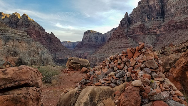
This first leg took almost all of the daylight we had, in November the days are short and the light can quickly disappear behind the canyon wall. You’ll know that you are most of the way there when you reach some really big rock cairns. From here, you are almost there but you have one more descent to get down to the river level. At this point we were exhausted, running out of light, and our muscles were aching from putting on the breaks so many times to keep upright. We saw a clear spot with a circle of rocks and collapsed there to setup camp. The next morning, we realized this was the helicopter pad! Oops. Luckily, no helicopters came to land while we were there.
We soon realized there was a much better camping spot in the daylight the next morning. Closer to the river there’s a large sandy spot under a tree that ecologists have used as a research camp. They’ve got several large containers of camping equipment down there, obviously brought in by helicopter. Since nobody was there, we took advantage of sleeping on the soft sand in this spot with the shelter of the trees to break the wind. We also borrowed their camp chairs, but made sure to leave everything exactly as we found it when we left.
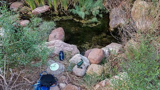
For water replenishment there’s also a spring near the camp, on the other side of the heli-pad. We found this water to drinkable after filtering, but the high mineral content makes it taste horrible. We managed to stay healthy drinking it, despite some gross aftertaste and weird burps. We filled up on this “poop water” as we called it to get ready for our 12 mile round trip to the confluence.
The Trail to the Confluence
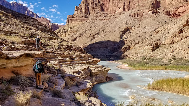
The trail out to the confluence starts along the river and it was quite muddy. You might even consider that maybe there’s a better option, but there’s really not unless you prefer climbing and bouldering on an unmarked trail. It’s quicker to really just slog through the mud for about a mile to the point where you’ll cross the river. (at which point you can clean your boots) This is really the hardest and most challenging part of this second trail, on the other side a nice wide, maintained and potentially dry trail awaits you. In fact, you can trace this trail on Google Maps satellite imagery almost all the way to the confluence.
After about a mile down the trail we found a large travertine dam in a wide spot on the river, this was the safest place to cross with the most shallow water. We only managed to get up to waist deep in one spot. Our packs and equipment remained dry for the most part, but we put the camera equipment in dry bags just to be safe. Crossing the river can be difficult barefoot, due to slippery rocks, solid water shoes or just keeping your boots on might be the best option to maintain your footing.
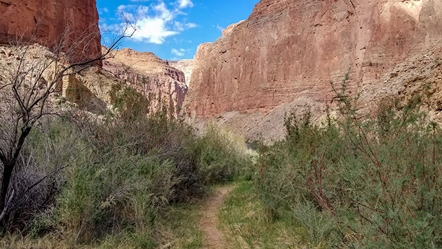
On the other side is a well maintained ecological research trail, a welcomed sight after our trek the day before and our mud slog that early morning. Not far from where we crossed, the Sipapu was on the other side of the river. The Hopi believe this to be a place where all life came to be, a sacred spot that they would rather we not disturb. Since we had been asked to not show it, we skipped photographing this spot. This is another reason to cross at the 1 mile point, it’s best if you don’t walk to the Sipapu, with respect we observed it from the other side of the river.
The rest of the trail here was fairly easy compared to what we had already done. There were a few spots where we had to climb boulders, and near the end you have to walk out on ledges over a sheer drop into the river. But this spot was more beautiful than it was dangerous.
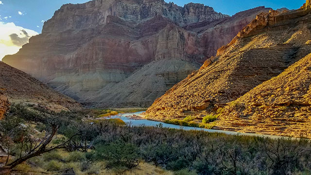
Arriving at the Confluence
When we finally arrived at the confluence, we were greeted by a private river rafting trip that had stopped at the confluence to check out the beautiful blue waters. I can tell you, I’ve never been so excited to be offered a cold beer! They only stayed for a short while, had we been any earlier or later, we would have missed out. Not only this, but the Colorado was running crisp and clean. We dumped out the remainder of our “poop water” and pumped every single container we had with clean and refreshing Colorado River water.
At this point, we knew we would run out of daylight on the way back, so we took our time to capture our 360 video shots and even got a short interview with the river guide before they took off. Come to find out, the brother of the river guide who appears in our Rogue River Journey 360 video who had met Thomas Hayden before was on this trip! What a small world! After the rafting trip took off, carefully packing all gear and leaving nothing behind, the confluence was back to looking completely untouched. We got our secluded shots with no people in them and prepared to hit the trail home. With lunch and cold beer in our bellies, along with a whole bunch of fresh great tasting water, we were energized to get back to camp.
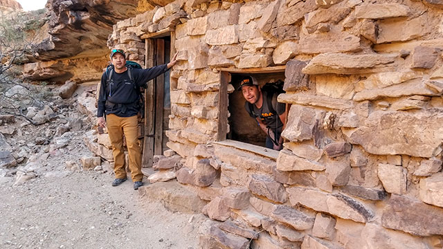
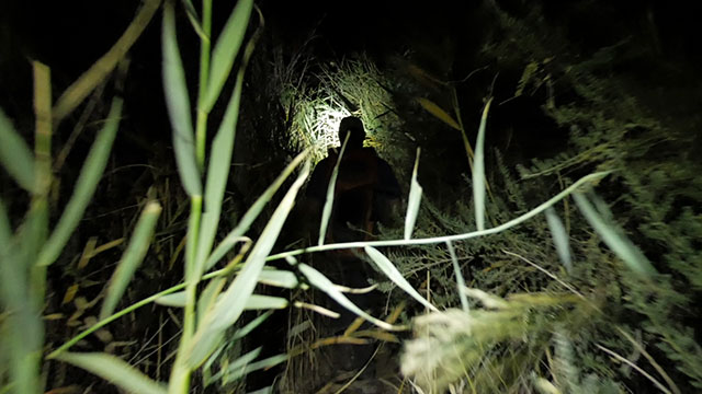
We stopped for a quick look at Beamer's cabin, built in 1890, on the way out. We ran out of daylight in about 2 hours, but luckily we had planned ahead and brought headlamps. The moon was also full and bright, and the temperature was very mellow. At the rim in Grand Canyon National Park, it was barely warm enough to take off a jacket in the middle of the day, but down in the canyon it was so warm we had to sleep on top of our sleeping bags at night. This was a godsend because we knew we would have to cross the river one more time, in the dark.
On the way back, we thought about delaying our cross of the river as long as possible, to hopefully avoid slogging through the mud again on the other side. Unfortunately, we had to double back to one of the travertine dams and cross there instead. The trail on the other side seemed to stop at a spring, and the river was very deep that point. We made it back into our camp at around 10pm, after crossing the river in full moonlight.
After a late meal and some sleep, we were up again at 5:30am to prepare to leave at first light after having some breakfast. The climb out and the 3,300 foot elevation gain was a lot easier than we had thought. Thankfully, leaving early meant we were pretty much in the shade until the very end. We made decent time, coming out in about five hours with moderate breaks throughout. The water cache we had left for ourselves was still waiting for us in our hiding spot.
Can’t Wait to Go Back!
Overall, we saw more people than I had imagined along the way. We ran into two guys who had repelled Big Canyon on the morning of our trek to the confluence, met one other hiker along with a rafting trip folks at the confluence, and ran into a group of three hikers on the way out. Despite this, for the most part the land is untouched. We didn’t see a single piece of trash, not a cigarette butt or a can in miles. If you decide to go, please keep it that way!
This was one of the most incredible hikes I’ve ever been on, and I’ve been to some pretty amazing places. But I can’t help but think that my opinion was influenced by the absolutely perfect weather conditions we had, both for hiking and photo taking. I certainly hope to go back some day. You can learn more about our trip and our production by checking out our behind the scenes video.